Feb 26, 2016 / Haseeb Jamal -

5 Travel Myths You Need to Stop Believing Right Now

Feb 26, 2016 / Haseeb Jamal -

Canal Comes Alive with Lighted Boat Parade.

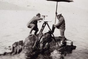
Intersection Method of Plane Table Surveying

Select two instrument stations P and Q, such that all the points or details to be located are visible from both the stations. Now set the table on P and make it centered and level. Using the plumbing form locate the ground station on the sheet i.e. p, such that the point p on the sheet is exactly over the point P on the ground. Measure the distance between P

Physical Features of the Earth

Physical features refer to the natural characteristics and elements of a particular geographical area. They include various aspects such as mountains, rivers, slopes, plains, and other landforms. These features are essential for understanding the topography and geography of a region. The physical features map includes the existence of the: Mountains Rivers Slope or plain area

Ground Control

In order to produce an accurate map from aerial photograph it is absolutely necessary to established ground control. It consists in locating the positions of a no of pts. All over the area to be surveyed det their levels. These control pts short be such that can be easily identified on the photographs.

Surveying Dictionary Words Definitions Starting from M, N, O, P

Magnetic declination is the horizontal angle between true north (i.e., the geographic meridian) and magnetic north (i.e., the magnetic meridian). There are two conventions for specifying the angle. One is to indicate the magnitude (e.g., 6o) and direction as E or W of north. The other considers positive values to be toward the east and negative values to be toward the west.

Surveying Dictionary Words Definitions Starting from E, F, G

The right, privilege or liberty given to a person or group to use land belonging to another for a specific and definite purpose e.g. the right given to an electricity company to bring electricity transmission lines across a private property. EDM is a relatively new technique that is still evolving and improving. It was first introduced in 1948 by Swedish physicist Erik

Surveying Dictionary Words Starting from C

A public register of land recording the extent and value of land parcels for the purposes A dataset containing information related to land ownership and rights. This usually takes the form of maps and descriptions of uniquely identifiable land parcels. For each parcel, legal information such as ownership, easements and mortgages are recorded more information can be

Surveying Dictionary Words Definitions Starting from H, I, J, K, L

The makeup or relative proportion of the General cover categories occurring about a point (see Primary sample unit).... The arrangement of the nine General cover categories occurring about a point (see Primary sample unit). .... A subcategory of Cropland managed for the production of forage crops that are machine harvested. The crop may be grasses, legumes, or

D - Glossary of Engineering Levelling & Surveying

A representation of facts, concepts or instructions in a formalized manner suitable for communication, interpretation or processing.... The encoding of data. In the context of digital mapping, this includes digitizing, direct recording by electronic survey instruments and the encoding of text and attributes by whatever means.... A specification that defines the order in

Measurements in Surveying

In Surveying all measurements are horizontal, can be inclined; reduce to horizontal and vertical components in plotting. Distance between 2 points on a plan or map is always horizontal distance irrespective of their elevation,(distance between their projection on horizontal plane). How are these Measured and which instrument should I use? Distances (Horizontal):

What are Survey Stations and How to Select a Survey Station

Survey Stations is a point of importance at the beginning and end of chain line. There are two types of survey stations: ... These are the end of survey line i.e. which connects boundaries. Line joining Main Stations is called Main Survey Line or Chain Line.

Direction Measuring Equipment in Surveying

Box compasses must be used with angle – measuring instruments, as the compasses operate only when the line of sight points towards magnetic north. The bearing desired must then be measured from his direction. Circular compasses can be mounted on theodolites and are often permanently mounted on transits. When provided with open sights, they can be used

Surveying Dictionary Words Starting from B

A back-sight is a reading taken on a position of known coordinate(s). Since a survey progresses from a point of known position to points of unknown position, a back sight is a reading looking "backward" along the line of progress. The first reading of almost any survey job should be a back-sight onto a fixed point of reference, usually a benchmark of some sort.

Surveying Dictionary Words Starting from A

A measure which indicates how closely the coordinates of a point in Ordnance Survey map data agree with the true National Grid coordinates of the same point on the ground. As the true position can never be known exactly, the statistic is quoted relative to the best known position determined by precise survey methods. A coordinate pair or triplate measured directly from

Types of Circular Curves in Surveying

In the geometric design of motorways, railways, pipelines, etc., the design and setting out of curves is an important aspect of the engineer’s work. The initial design is usually based on a series of straight sections whose positions are defined largely by the topography of the area. The intersections of pairs of straights are then connected by horizontal curves.

Baseline Measurement and Equipments Used

In triangulation the base line is of prime importance because it is the only horizontal distance to be measured. It should be measured very accurately since the accuracy of the computed sides of triangulation system depends on it.

Search AboutCivil