Intersection Method of Plane Table Surveying

Radiation Method of Plane Tabling
Instruments Required for Plane Table Survey:
- Tripod
- Plane Table
- Plumbing Fork
- Level
- Magnetic needle compass
- Alidade
- Measuring Tape
- Ranging Rods (For demonstration purpose)
- Other accessories
- 28in x 22in drawing sheet
- Scotch Tape
- Chisel pointed Pencil
- Eraser
Procedure:
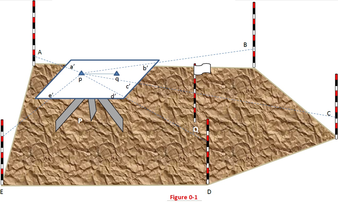
- Select two instrument stations P and Q, such that all the points or details to be located are visible from both the stations.
- Now set the table on P and make it centered and level.
- Using the plumbing form locate the ground station on the sheet i.e. p, such that the point p on the sheet is exactly over the point P on the ground.
- Measure the distance between P and Q.
- Now using the alidade pivoted at P orient the table so that other instrument station Q is sighted and clamp the table and draw a line along the fidicual edge of the alidade according to a suitable scale. This line pq is a base line and hence must be measured and drawn accurately
- With the alidade pivoted on p sight other details and draw rays as a’, b’ c’, d’ etc as shown in Figure 0-1
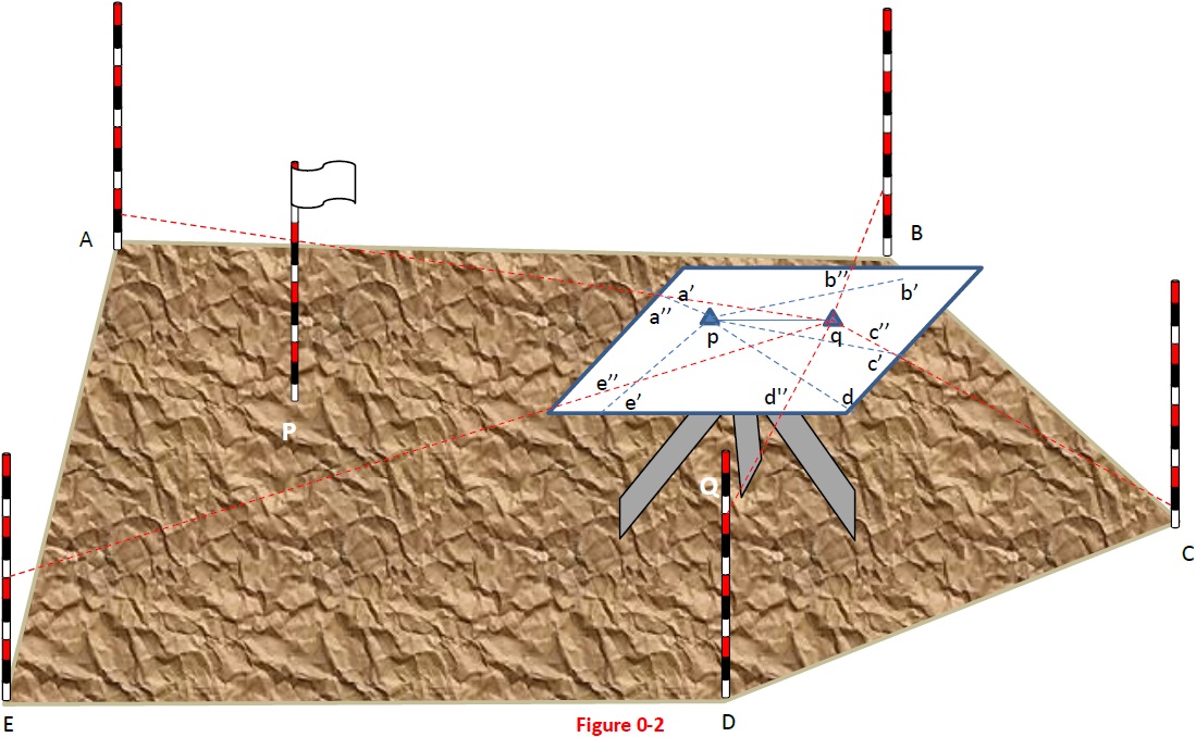
- Now shift the table to station Q and make it centered and leveled such that point q on sheet is exactly above the Q on the ground
- With the alidade placed along line pq orient the table and back sight the station P and clamp the table.
- With the alidade pivoted on q sight other details and draw rays as a’’, b’’ c’’, d’’ etc as shown in Figure 0-2
- The intersection of a’, b’ c’, d’, e’ with a’’, b’’ c’’, d’’, e’’ are named as a, b, c, d, e respectively. Join a, b, c, d, e as shown in Figure 0-3
NOTE: These details may be building corners, electric towers, tree, manhole etc. But for demonstration purpose we will put ranging rods.
Significance and Applications
In this method a base line is drawn between two instrument stations. The significance of this method is that only the base line is measured and plotted to scale very accurately. Other points or details depends on the scale and accuracy of the base line. It is used when:
- The ground is not level and smooth
- Distances are so large that cannot be measured with single tape