Surveying Dictionary Words Definitions Starting from H, I, J, K, L

Habitat composition
The makeup or relative proportion of the General cover categories occurring about a point (see Primary sample unit).
Habitat configuration
The arrangement of the nine General cover categories occurring about a point (see Primary sample unit).
Hayland
A subcategory of Cropland managed for the production of forage crops that are machine harvested. The crop may be grasses, legumes, or a combination of both. Hayland also includes land in set-aside or other short-term agricultural programs.
Hand Level
A hand level is a small scope fitted with a spirit level that is visible while looking through the scope. It is used to make rough estimates of relative elevations.
Height of Collimation
Height of Collimation is the elevation of the optical axis of the telescope at the time of the setup. The line of collimation is the imaginary line at the elevation.
Horticultural cropland
A subcategory of Cropland used for growing fruit, nut, berry, vineyard, and other bush fruit and similar crops. Nurseries and other ornamental plantings are included.
Hydrographic Surveying
The measurement and description of the physical features offshore and adjoining coastal areas with special reference to their use for the purpose of navigation.
Independent Polygon
One of the options for OS MasterMap product feature geometry/topology in which the data is simplified into area, point and line features with no relationship between them and with their own explicit geometry. For example, in the Independent Polygon product, the bounding line between two areas will be represented three times, each with its own description of the geometry: once as a line feature, once as part of the bounding line of the first area feature and once as the bounding line of the second area feature.
Isoline
A line joining points of equal value. Examples of these include height contours on a map or isobars showing atmospheric pressure on a weather map.
Land cover/use
A term that includes categories of land cover and categories of land use. Land cover is the vegetation or other kind of material that covers the land surface. Land use is the purpose of human activity on the land; it is usually, but not always, related to land cover. The NRI uses the term land cover/use to identify categories that account for all the surface area of the United States.
Land capability classification (class and subclass)
Land capability classification is a system of grouping soils primarily on the basis of their capability to produce common cultivated crops and pasture plants without deteriorating over a long period. Land capability classification is subdivided into capability class and capability subclass nationally.
Latitude
The angular distance along a meridian measured from the Equator, either north or south.
Level Surface
A level surface is a surface which is everywhere perpendicular to the direction of the force of gravity. An example is the surface of a completely still lake. For ordinary levelling, level surfaces at different elevations can be considered to be parallel.
Level Datum
A level datum is an arbitrary level surface to which elevations are referred. The most common surveying datum is mean sea-level (MSL), but as hydrological work is usually just concerned with levels in a local area, we often use:
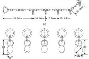
Lockspit
Trenches dug beside a peg or post along the survey lines from the corner of a subject parcel. An example clause taken from the 1916 'Rules and Regulations for the Guidance of Surveyors' states:
On each side of the split pegs, and distant about one foot, lockspits, three feet in length and six inches in depth, are ... to be dug in the direction of the surveyed line. On very stony lands, rows of stones placed in the direction of the surveyed line may be substituted for dug-out lockspits.
Longitude
The angular distance measured from a reference meridian, Greenwich, either east or west.