Types of and Uses of Photographic Surveying
Verticals are taken with the axis of the camera pointing vertically downward. These photographs can produce more accurate maps as the variation n scale over the area is smaller and no area remains hidden. However the details in photograph can not be easily identified as the view offered is unfamiliar to eyes. Oblique are produced by giving a camera a tilt up to 30 to theAngle Measuring Equipment in Surveying
The theodolite is the basic instrument for measuring horizontal and vertical angles. It consists essentially of a sighting tube in form of a telescope, an horizontal and vertical scales, which are so set that horizontal and vertical angles of the object sighted in the telescope can be read from the scale (see fig. 5 and 6)Civil Engineering Surveying
The process of determining by measurement, the relative positions of points above, on, or beneath the earth surface, in order to produce map or plan (which shows feature of the surface) in horizontal or vertical plane. The Term surveying refers to those measurements or operation, which deal in production of map or plan in horizontal plane.Common Definitions in Surveying
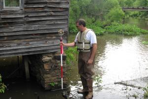
Levelling is the most widely used method of obtaining the elevations of ground points relative to a reference datum and is usually carried out as a separate procedure to those used in fixing planimetric position.Levelling in Engineering Survey
Levelling is the most widely used method of obtaining the elevations of ground points relative to a reference datum and is usually carried out as a separate procedure to those used in fixing planimetric position.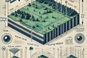
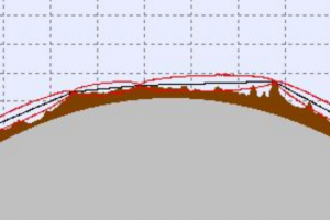
Scale and Distortion of a Vertical Photograph
The scale of the photograph is expressed as a representative fraction. (A scale having the importance that we can take it in any unit). Knowing the height of the airplanes above the datum and the focal length of the camera.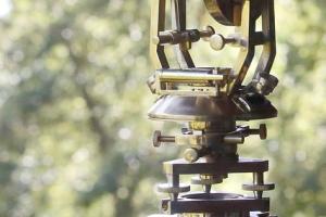
Levelling Tools & Equipment
The vertical measuring equipment in surveying are major summed into two but other instruments still exist. The two major ones are: Measurement by surveying levels Barometric – pressure devices
How to do Photogrammetry - Types and Applications of Photogrammetry
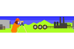
Photographic surveying is a method of surveying in which plans or maps are prepared from photographic taken at suitable camera stations or photographic is the science of making measurement from photographs. For large scale engineering and redevelopment projects, reconnaissance can be undertake in to a large extend form air photograph. Pollution effects fromDistance Measuring Equipment
The chain tape is also referred to as the Günter’s chain. Gunter’s chain, the 300 –year-old measuring instrument by which all survey measurement in the English – speaking countries and much of it elsewhere was done. It has been superseded by the steel tape and electronic equipment. Gunter’s chain is 66 feet long; 80 chain equal to one mile, and 10 square chains equals
Horizontal and Vertical Curves in Surveying
Curves are provided whenever a road changes its direction from right to S (vice versa) or changes its alignment from up to down (vice versa). Curves are a critical! element in the pavement design. They are provided with a maximum speed limit that should lie followed very strictly. Following the speed limit becomes essential as the exceed in speed may lead to the chances of