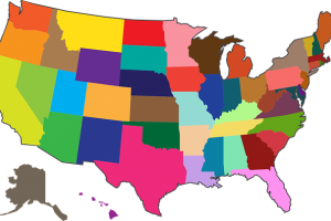
Integration of GPS and GIS for use in Urban Planning

The integration of Global Positioning System (GPS) and Geographic Information Systems (GIS) plays a crucial role in urban planning by providing accurate spatial data and analysis tools. This integration enables urban planners, government agencies, and developers to make informed decisions about land use, infrastructure development, and overall city management.
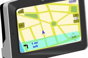
- GPS are becoming very effective tools for GIS data capture.
- The GIS user community benefits from the use of GPS for location data capture in various GIS applications.
- The GPS can easily be linked to a laptop computer in the field, and with appropriate software.
- Thus GPS can help in several aspects of construction of accurate and timely GIS databases.
- GIS is about “What”? For example, "what" is the object or objects which will be mapped.
- These objects are referred to as "Features“ and are used to build a GIS.
- It is the power of GPS to precisely locate these Features which adds so much to the utility of the GIS system.
- On the other hand, without Feature data, a coordinate location is of little value.
How GPS and GIS are used in urban planning
Data Collection:
- GPS is used to collect precise location data, including coordinates (latitude and longitude) of various urban features, such as roads, buildings, utilities, parks, and landmarks.
- GIS tools allow the integration of this GPS-collected data into a spatial database. This data can be in the form of points, lines, or polygons, depending on the feature being mapped.
Asset Management:
- Urban planners can use GIS to manage and maintain data related to urban assets like roads, bridges, water supply systems, and sewer networks. GPS data can help accurately locate and monitor the condition of these assets.
Urban Infrastructure Planning:
- GPS data can be used to identify areas in need of infrastructure development, repair, or maintenance.
- GIS tools enable planners to create thematic maps, overlaying GPS-collected data with other relevant information like population density, land use, and environmental factors, to make informed decisions about infrastructure placement and design.
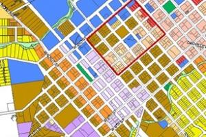
Land Use Planning:
- GIS can store information on land parcels, zoning regulations, and property boundaries.
- GPS data can help assess the current land use and monitor changes over time, allowing urban planners to make decisions about zoning, land allocation, and development permits.
Transportation Planning:
- GPS data from vehicles and mobile apps can provide valuable insights into traffic patterns, congestion, and public transportation routes.
- GIS analysis can help optimize transportation systems, plan for new roads, and evaluate the efficiency of public transit networks.
Emergency Response and Management:
- GPS data is essential for locating incidents and emergencies in urban areas.
- GIS can be used to create emergency response plans, assess risk areas, and optimize the allocation of resources during crises.
Environmental Planning:
- GPS data can be used to track and monitor environmental changes, such as deforestation, urban sprawl, and pollution.
- GIS tools allow urban planners to analyze and model the environmental impact of various development scenarios.
Urban Design:
- GIS can aid in the visualization of proposed urban designs and architectural plans.
- GPS data can be used to assess the physical characteristics of an area, helping architects and urban designers make informed decisions.
Public Engagement:
- GIS can be used to create interactive maps that engage the public in urban planning processes, enabling citizens to provide feedback and participate in decision-making.
Monitoring and Assessment:
- GPS and GIS allow urban planners to monitor the effectiveness of previous decisions and adapt to changing circumstances by collecting, analyzing, and visualizing data over time.
Types of Features which can be Mapped in GIS
There are three types of features which can be mapped:
- Points
- Lines and
- Areas.
Point:
A Point Feature is a single GPS coordinate position which is identified with a specific Object.
Line:
A Line Feature is a collection of GPS positions which are identified with the same Object and linked together to form a line.
Polygon:
An Area Feature is very similar to a Line Feature, except that the ends of the line are tied to each other to form a closed area.
Describing Feature-attributes:
Categories of descriptions for a Feature are known as Attributes of that feature.
- Attributes can be thought of as questions which are asked about the Feature. For example the Attributes of the Feature "house" would be "color", "size", "cost" and "occupants".
- A Feature is the object which will be mapped by the GPS system. The ability to describe a Feature in terms of a multi-layered database is essential for successful integration with any GIS system.
- For example, it is possible to map the location of each house on a city block and simply label each coordinate position as a house. But the additional information such as color, size, cost, occupants, etc. will provide the ability to sort and classify the houses by these categories.
Describing Attribute-Values
- Logically, each question asked by the Attributes must have an answer.
- The answers to the questions posed by the Attributes are called Values. In the example above, an appropriate Value (answer) for the Attribute (question) "color" may be "blue".
The following table illustrates the relationship between Features, Attributes and Values:
By collecting the same type of data for each house which is mapped, a database is created.
Feature List:
- The Feature List is a database which contains a listing of the Features which will be mapped, as well as the associated Attributes for each Feature.
- Feature List also contains a selection of appropriate Values for each Attribute.
- When a Feature List is used in the field, the first step is to select the Feature to be mapped. Once a Feature is selected, the Attributes for that Feature are automatically listed. A Value for each Attribute can then be selected from the displayed list of predetermined Values.
- Objective of making a feature list: To simplify the data entry process.
Exporting to a GIS System:
- The final step in integrating GPS data with a GIS system is to export the GPS and Feature data into the GIS system. During this process, a GIS "layer" is created for each Feature in the GPS job. For example, the process of exporting a GPS job which contains data for House, Road and Lot Features would create a House layer, a Road layer and a Lot layer in the GIS system. These layers can then be integrated with existing GIS data.
- Once the GPS job has been exported, the full power of the GIS system can be used to classify and evaluate the data.