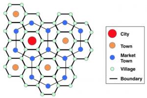
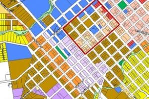
Classification of Urban Land Use

Residential:
Amount of land depends on the of which new households are formed and on immigration.
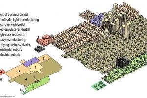
Commercial areas:
Category includes all types of wholesale, retail and service activities serving areas larger than neighborhoods. Included in this category are the ff:
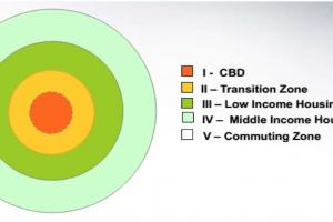
- Major Central Business Districts in urbanized areas
- Minor Central Business District in less urbanized areas
- Highway Service Centers or Commercial Strips such as highway gas stations, traveler's inn and restaurants
![]() Also Read: Criteria for Site Selection for Different Structures | MasterPlan of a City
Also Read: Criteria for Site Selection for Different Structures | MasterPlan of a City
Institutional Areas:
It covers the major public and semi-public uses like educational, cultural, religious, health, protective and government services
Industrial uses:
- It includes manufacturing, refining, fabricating, assembly, storage, parking and other incidental uses including food processing, cottage industry, sawmills, rice mills, steel mills, chemical processing plants, etc
- Also included are the proposed industrial estates/subdivision
- Parks/Playgrounds and other Recreational Areas the space requirement may be computed with the use of space standards based on population or area of the municipality or city
Open Space
The so called “non-functional open spaces” and includes lands reserved for greenbelts and buffer zones; and other vacant lands reserved for specific or functional purposes
Constraints to Development
- Identify different constraints such as soil conditions, flooding, volcanic eruptions, earthquakes, and other natural condition
- Mapping guidelines illustrates the physical obstacles to development such as subsidence and flooding risk
Land Use Related Problem
- Evaluate the land use related problems such as flooding, deforestation, conversion of prime agricultural lands, pollution, incompatible uses, etc.
Factors for Designation of Functional Areas
- The identified population needs and requirement for various development purposes
- Land requirement in terms of adequacy of land for food production, settlement expansion, etc.
- The location of the different land use categories as follows:
- Agriculture
- Forest
- Built-up
- Tourism
Recognized need to protect and preserve critical areas for conservation and preservation
- Development Areas include croplands (paddy, rice, coconut, sugar cane, orchard, diversified crops,etc.) and livestock production (feeding operations, or open grazing); settlement areas such as growth centers and ethnic reserves; military reservation and other urban uses which required relatively large areas like industrial estates and utilities
- Conservation and Preservation Areas
- maintain the desired ecological balance and area characteristic
- to protect the integrity of sensitive/critical ecosystem
- to preserve their natural or unique characteristic
Formulation of the General Land Use Plan:
Land Capability Classification
- indicates the suitability of areas for cultivation according to soil conservation management requirements. Factors considered in the identification of land capability classes are soil erosion potential/flooding and soil condition limitations.
Soil condition:
- Includes its characteristics such as drought, fertility, stoniness, salinity, alkalinity, acidity, depth, presence of toxic substance, etc.
- The degree of limitations ranges from no or slight limitations, moderate, serious to severe, to very serious or very severe
The different land capability classes are as follows:
- Class A – very good land; can be cultivated safely, requiring only simple but good farm management practices.
- Class B – good land; can be cultivated safely, require easily applicable conservation practices.
- Class C – moderately good land, must be cultivated with caution; requires careful management and complex conservation practices.
- Class D – fairly good land; must be cultivated with extra caution; requires careful management and complex conservation practices for safe cultivation. Most suitable for pasture or forest.
- Class L – level to nearly level; too stony or very wet for cultivation; limited to pasture or forest with careful soil management.
- Class M – steep land; very severely eroded; shallow; not for cultivation; limited to pasture or forest with careful management.
- Class X – level land; wet most of the time and cannot be economically drained; suited for fishpond or recreation.
- Class Y – very hilly and mountainous, barren and rugged; should be reserved for recreation and wildlife or for reforestation.
Soil Suitability
A soil suitability study shall be conducted to determine the appropriateness of agricultural lands for specific crops. At present, the Bureau of Soils and Water Management has prepared Crop Development and Soil conservation Planning Guide Maps for various crops.
Environmentally Critical Areas
Land development should consider the limitations posed by these hazards. These areas include the ff:
Weather and Water Related Hazards:
- tropical cyclone winds
- tropical cyclone rains
- storm surge
- drought
Earthquake Induced Hazards
- ground shaking
- ground rupture
- liquefaction and lateral spreading
- landslides
- tsunami
Volcanic Hazards:
- lava flow
- airfall
- pyroclastic flows
- lahar
- edifice failure
Erosion:
- soil erosion
- river bank erosion
- coastal wave erosion
Environmentally Critical Areas:
Other Environmentally Critical Areas covered by the Presidential Proclamation No. 2146
- areas set aside as aesthetic potential tourist spots;
- areas of unique historic, archeological or scientific interest;
- areas which are traditionally occupied by cultural minority communities or tribes;
- areas classified as prime agricultural lands;
- recharge areas of aquifers;
water bodies characterized by one or any combination of the following conditions;
- tapped for domestic purposes
- within the controlled and/or protected areas declared by appropriate authorities
- support wild life and fishery activities
coral reef characterized by one or any combination of the ff. conditions:
- with 50% and above live coraline cover
- spawning and nursery grounds for fish
- act as natural breakwater of coastline