Land Use Planning - Techniques, Classification & Objectives

It is the systematic approach / process for identifying, classifying and locating urban land, which is achieved by analyzing the socioeconomic needs of the population in consideration of the physical and natural attributes of a city / municipality
-
Land use planning refers to the rational and judicious approach of allocating available land resources to different land using activities, (e.g. agricultural, residential, industrial) and for different functions consistent with the overall development vision/goal of a particular locality.
-
It entails the detailed process of determining the location and area of land required for the implementation of social and economic development, policies, plans, programs and projects.
-
It is based on consideration of physical planning standards, development vision, goals and objective, analysis of actual and potential physical conditions of land and development constraints and opportunities.

Technical aspect of Land use Planning:
It involves determining what activities(agricultural, construction) a given piece of land can support without causing damage to the land itself in order it can be used across many generations without jeopardizing.
![]() Also Read: Criteria for Site Selection for Different Structures | Urban Solid Waste Management | MasterPlan of a City
Also Read: Criteria for Site Selection for Different Structures | Urban Solid Waste Management | MasterPlan of a City
Political aspect of Landd use Planning:
is concerned with the commitment of decision makers and politicians to ensure that there is strict compliance with the plan and its implementation tools.
What is a Land Use Plan?
An essential component of the comprehensive development plan, it designates the future use or reuse of the land and the structure built upon the land within a given jurisdiction’s planning area and the policies and reasoning used in arriving at the decisions in the plan
It projects public and private land uses in accordance with the planned spatial organization of economic and social activities and the traffic of goods and people
Objectives of Land Use Planning
- To promote the efficient utilization, acquisition and disposition of land as a limited resources;
- Make sure there is enough for our future generations to use and enjoy while addressing the needs of the present times
- To influence, direct and harmonize decisions and activities of the public and the private sectors affecting the use, management and disposition of lands;
- Reconcile land use conflicts between and among individuals and government agencies relating to present needs and anticipated demands for land;
- Promote desirable and efficient patterns of land uses and prevent premature and wasteful development and minimize the cost of public facilities, services and infrastructure;
- Protect and preserve valuable agricultural areas consistent with the need to promote industrialization;
- Maintain ecological balance thru Control of development in critical areas such as flood plains and watershed areas;
- Integrate programs and projects on land resources development among land development agencies;
- Conserve areas of ecological, aesthetic and historical values and maintain and protect natural open areas and areas of significant views;
- Promote and implement a shelter plan
- Thru Identification of sites suitable for housing; and
- Promote an efficient circulation system
Overview of the Process
It utilizes the planning methodology which includes: data gathering, problem identification and situational analysis; goals / objectives formulation; generation of alternative spatial strategies; evaluation and selection of preferred strategy; formulation of the plan; adoption, review and approval; and implementation and monitoring
Classification of Land Use Planning:
General Land Use Planning:
It deals primarily with the non-urban large scale uses such as: croplands, forests, pasture lands, mining/quarrying areas and swamplands, with areas occupied by structures treated collectively as “built –up” areas”
Urban Land Use Planning:
It is concerned with the location, intensity and amount of land development required for the various space using functions such as residential, commercial, industrial, institutional, recreation and other activities found in the urban areas.
Land Use:
General Land use:
Four Major Categories:
- Builtup
- Agriculture
- Forest
- Special use
Urban Land uses:
- Residential
- Commercial
- Industrial
- Institutional
- Parks/playgrounds
- Infrastructure/Utilities
The classification of land use planning can be broadly categorized into general land use planning and urban land use planning. Here's an explanation of each category and its corresponding land use classifications:
General Land Use Planning:
General land use planning focuses on non-urban large-scale land uses and natural resource management. It deals with the allocation and management of land for various purposes such as croplands, forests, pasture lands, mining/quarrying areas, and swamplands. In general land use planning, areas occupied by structures are treated collectively as "built-up" areas. The major land use categories in general land use planning are:
-
Built-up: This category includes areas that are developed and occupied by structures, such as residential, commercial, and industrial buildings, as well as infrastructure and utilities.
-
Agriculture: This category comprises lands used for agricultural activities, including crop cultivation, livestock rearing, and other agricultural practices.
-
Forest: This category encompasses areas covered by forests or wooded lands, which may be managed for timber production, conservation, or recreational purposes.
-
Special Use: This category includes areas designated for specific purposes that do not fall under the other major land use categories. This can include protected areas, natural reserves, wetlands, wildlife habitats, and cultural heritage sites.
Urban Land Use Planning:
Urban land use planning focuses on land use within urban areas, which are characterized by high population densities and built-up environments. It is concerned with determining the location, intensity, and amount of land development required for various functions in urban areas. The major land use categories in urban land use planning are:
-
Residential: This category includes areas designated for housing and residential purposes, including single-family homes, apartments, and mixed-use residential areas.
-
Commercial: This category comprises areas designated for commercial activities, such as retail shops, offices, shopping centers, and commercial services.
-
Industrial: This category encompasses areas designated for industrial activities, including manufacturing facilities, warehouses, industrial parks, and logistics centers.
-
Institutional: This category includes areas designated for institutional uses, such as schools, hospitals, government offices, religious buildings, and community centers.
-
Parks/Playgrounds: This category comprises areas designated for recreational purposes, including parks, playgrounds, sports fields, and open green spaces.
-
Infrastructure/Utilities: This category includes areas allocated for essential infrastructure and utilities, such as roads, transportation networks, water supply facilities, sewage systems, and power distribution.
These land use classifications serve as a framework for land use planning and help guide decision-making processes related to zoning, development regulations, and urban growth management. The specific classifications and their definitions may vary based on regional or local planning regulations and practices.
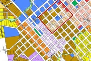
Land Use Categories & Color Coding:


Determination of Land Supply for Urban Expansion:
Land supply is the land area available within the city/municipality for urban expansion. Basically, this is left after deducting the areas considered for protection/preservation and conservation such as the Network of Protected Agricultural Areas (NPAAs), National Integrated Protected Areas System (NIPAs), existing built-up areas, etc.
Formula:
Land Supply For Urban Expansion = TLA – (PCA + BU)
Where: TLA = total land area of city/municipality, in hectares
PCA = protection/preservation and conservation areas, in hectares
BU = built up areas, in hectares