Location Survey for Roads & Highways

The aim of location survey for roads is to select a route with the following points kept in mind:
- With reasonable economy it should meet the minimum requirement regarding curvature and grades.
- To produce an easy riding (traveling), free flowing traffic artery that has a high capacity and it meets all the safety standards.
- The location survey for roads should recognize and evaluate the routes impact on already existing industries, business, and residential values and on future development.
- Minimal disruption to historic, archeological, and environmental sites.
Before field survey for any highway location is started, tentative decision, regarding the design speed of the route, its cross-section, and the maximum grade must be made. These decision made are based on the:
- Estimated of amount, character and hourly distribution of traffic, along with
- Knowledge of the area is traversed.
- And available funds.
RESULTING ROUTE: After comparison of the different alternative design, the route is selected which has cheapest overall cost, considering capital investment, maintenance, expense and saving to the road user.
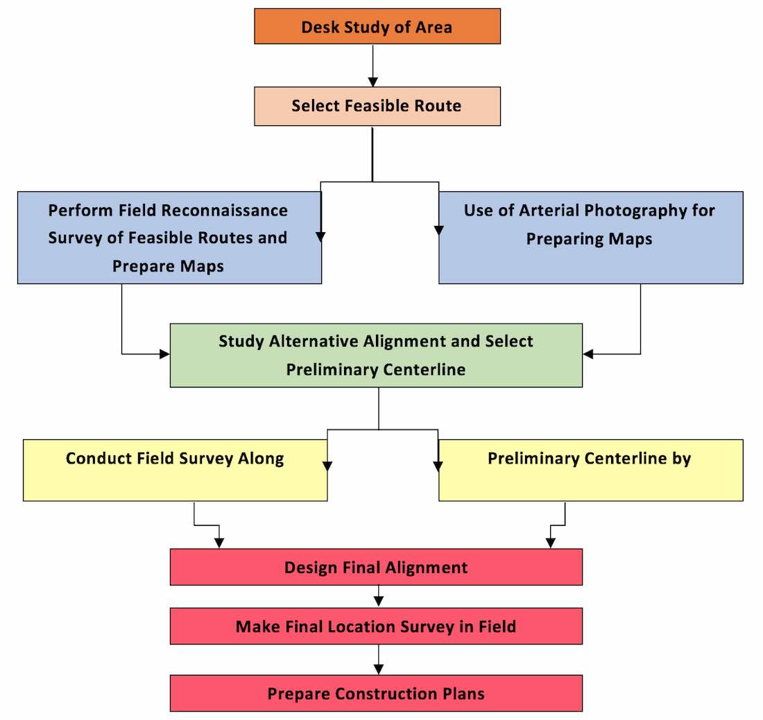
Rural Highway Location Survey and Design Process
The rural highway location and design process is elaborated in a flow chart given below (which are then discussed one by one.)
1. Desk Study of the Area:
The possible desk study for highway of an area include; Maps, Aerial photographs, charts or graphs to obtains, engineering data, environmental data, social data, economic data. Following characteristics should be learnt in the desk study of the area for location survey for roads:
Engineering Data:
All details of the topography, soil and problems like drainage and maintenance, should be investigated before a scientific plan programmed can be suggested. The engineering data includes following things:
- Topographic and geological maps.
- Stream and drainage basin maps.
- Climatic records.
- Preliminary survey maps of previous projects.
- Traffic surveys and capacity studies.
Environmental Data:
The environmental data required for desk study of area includes:
- Agricultural soil surveys indicating soil erodibility.
- Air pollution studies.
- Noise and noise attenuation studies.
- Fish and wild life inventories.
- Historical studies.
Social Data:
The social data obtained may be analyzed for future trends in development of an area. It includes:
- Demographic and land use information.
- Census data.
- Zoning plans and trends.
- Building permit records, motor vehicle registration records.
- Living standards of locality.
Economic Data:
The economic data is essential to study the various financial aspects like source of income and manner in which funds for project may be mobilized for location survey for roads. It includes:
- Overall cost of previous projects.
- Unit construction costs data.
- Agricultural, economical and industrial data etc.
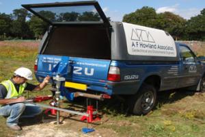
2. Reconnaissance Survey For Highway Location In Rural Area
The objective is to identify several feasible routes. Following two methods can be employed for reconnaissance survey:
- Conventional ground method.
- Aerial photography.
Either or both of the below methods are undertaken to identify factors such as: Terrain and soil conditions, Serviceability, Crossing of other transportation facilities, Directness of route, Environmentally sensitive areas etc.
Conventional Ground Method:
In this method a field survey party inspects a fairly broad stretch of land along the proposed alternative routes of the map in the field for location survey for roads. Intensive reconnaissance is very important for highway location in a new country as well as where completes abandonment and replacement of an existing road are planned. The various steps of reconnaissance for highway location in a rural area are:
-
Initially help is taken from already available maps, particularly topographic maps of the area so that most promising general route may be laid out for careful inspection on the ground.
-
Once a route selected on the map by crude but rapid survey method, a survey is made along the path selected on the map.
-
Primary Controls are then established after it which include:
- Terminal of the road and intermediate points through which it must pass.
- Single mountain pass if no alternative exists.
- Small settlements, for secondary roads.
- Secondary Controls: Once primary controls are established the secondary controls are then considered which include:
- Drainage system.
- Mountain passes.
- Low points in ridges.
- Cost factors such as favorable and unfavorable soil conditions, the number and sizes of structures, the amount of excavation and embankment, alignment and grade.
- Possible Alignment
- In mountainous country with well defined summit ranges, there is usually a suitable pass along the drainage on both sides.
- The least expensive and frequently the straightest line may lie just above high water in streams often; however, the rise of valley may exceed the maximum permissible grade.
- At times a more favorable location lies on the hillside at some height above the stream.
- Mountain Location: On occasion, the route must climb from stream level to an adjoining pass or summit. The road must be long enough to provide for the required gain in elevation at max permissible rate.
Depending sooner from the level valley will result in climbing to summit in less grade and moderate curvature.
Excessive use of switch backs should be avoided. - In Snow Location: In sow areas locations should be confined to slopes exposed to the sun in order to avoid icing on the roadway and ease snow removal problems.
Reconnaissance Survey Report for Location Survey for Roads
This report must consist of:
- Total length of line.
- The elevation of main and intermediate summit
- All adverse grades.
- Stream crossing.
- Nature of construction.
- Right of way circumstances.
- Soil conditions.
- Unusual or troublesome condition.
- Approximate estimate of cost.
3. Preliminary Location Survey:
After the preferred location has been established, the preliminary location survey serves as basis for fixing the actual highway location. Economic evaluation of each possible route is considered along with Environmental Evaluation as highway construction has a significant impact on surroundings.
Conventionally the baseline of preliminary survey i.e. P-line should follow as closely as possible to the expected final line. The surrounding are then related to this P-line. Elevations - At 100 ft and at breaks in the ground provide data for profile and serve as starting point for cross-sections that covers a strip of land on each side of P-line.
Cross-section - are of width 100’ to 800’, depending upon:
- Standard of accuracy.
- Speed of work and instrument used.
However accurate measurements are used for checking the accuracy of final location. The next step is to plot plan and profile of the preliminary line.
4. Final Location Survey:
Final location is essentially fixing of the details of the projected highway. In this phase detailed layout of the selected route is finalized which includes Horizontal/vertical alignments, Positions of structures and drainage channels, Trial-and-error process by the designer for engineering and aesthetic factors. It serves the dual purpose of:
- Permanently establishing the center-line.
- Collecting information necessary for preparation of plans for construction.
The line should be established as closely as is practical to the line drawn on the preliminary map. It should follow the major and minor control points and the alignment that was determined in previous surveys. It is useful to make a new profile and accurate cross-section from which excavation and embankment quantities can be measured.
The final reconnaissance survey should have sufficient points of curvature and tangency and benchmarks at relatively close interval to avoid missing out any details. The position of these points should be free from disturbance by construction activities or other reasons. Direction of all property lines, distance to property corners and location of building, fences and other infrastructure should also be marked. It is important to keep notes on alignment and levels i.e. notes taken in field during the final location survey usually becomes part of permanent record.
The final location survey for roads is complete when all necessary information in available and ready for designer to use. It in insured that all information required preparation of complete construction. All information pertaining to the following factors must be completely available:
- Alignment
- Topography
- Bench mark levels
- Cross sections
- Section corner ties and other land ties
- Drainage and utilities